Exploration & Mining
Defense & Forensic
Infrastructure & Construction
Archaeology & Cultural heritage
Climate & Environmental
Groundwater & Geology
Learn more
ABEM
MALÅ
Software
Rental
Authorized Distributor
Care Program
News
Calendar (events)
Opinion pieces
Press releases
More reading
Vision
History
Career
Privacy policy
Code of conduct
Whistleblower
Get in touch
Get in touch with us for expert help
Explore our ABEM, MALÅ, Software and partnered products.
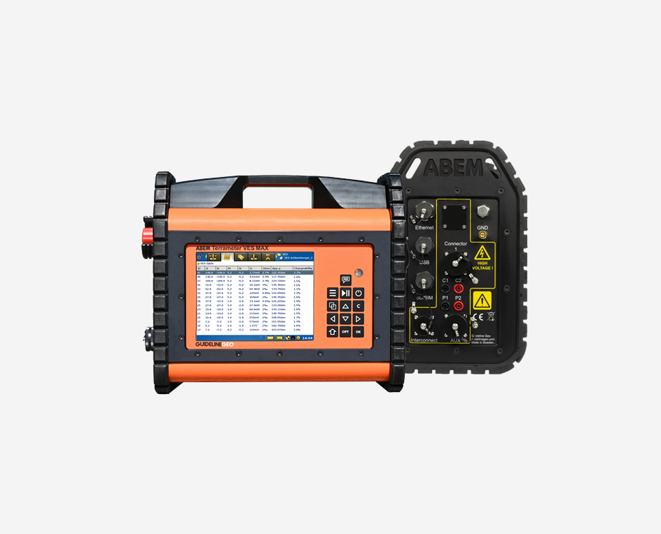
The only resistivity and IP surveying system you need
The world’s first AI-powered Ground Penetrating Radar (GPR) for Utility Locating and Underground Mapping
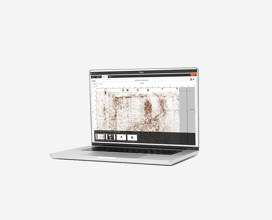
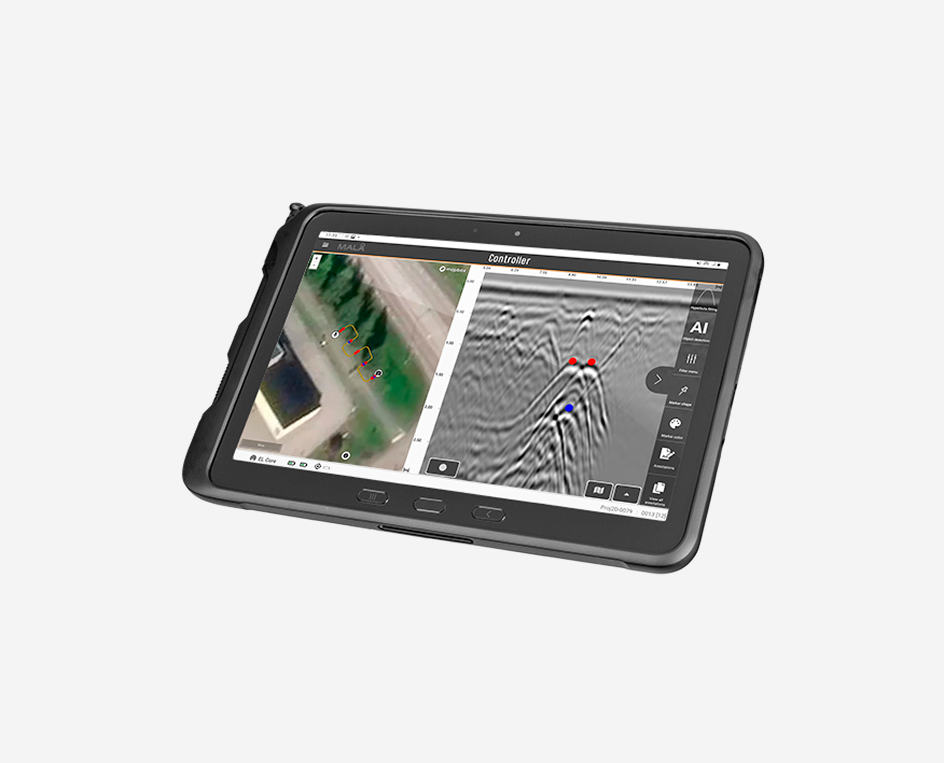
Intelligent GPR processing and analysis software on any device
Faster groundwater, mineral and environmental surveys
3D GPR mapping in a compact format
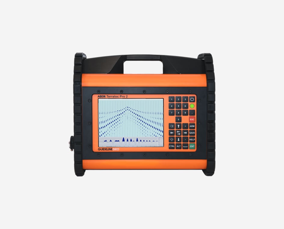
The rugged seismograph
A mobile TEM solution for rapid groundwater and environmental mapping
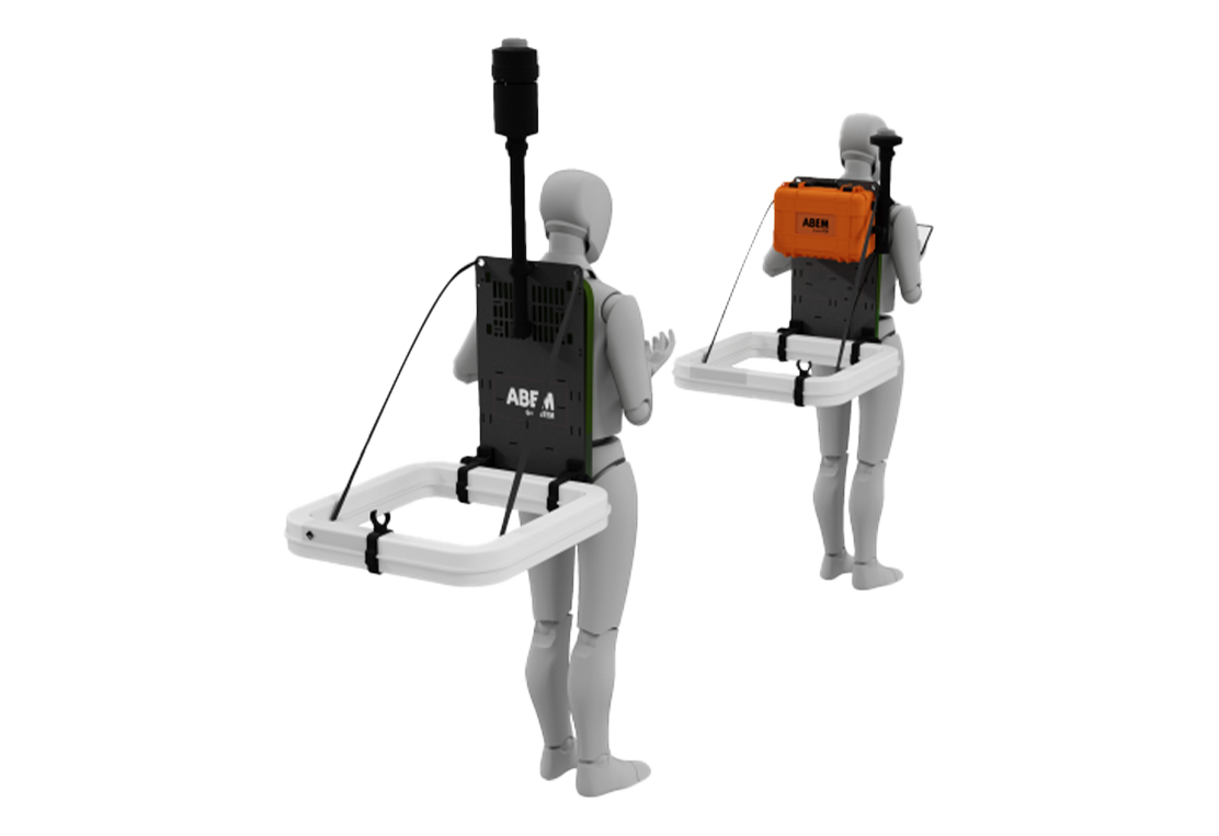
A backpack-mounted mobile TEM solution for rapid groundwater and environmental mapping
Greater Affordability & Ease-of-Use
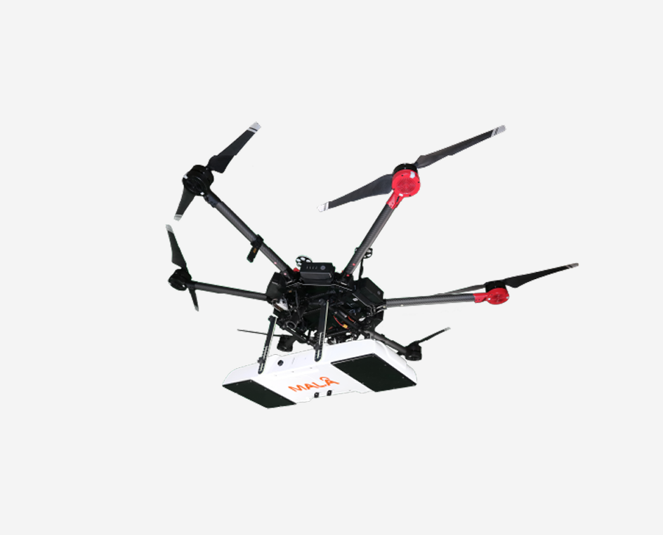
The cutting-edge drone-based GPR solution for unmanned surveying
Reliable data starts with well-built instruments
MALÅ GX (Ground Explorer) is an integrated GPR solution with a wide range of antenna options
GPR data acquisition on your mobile device.
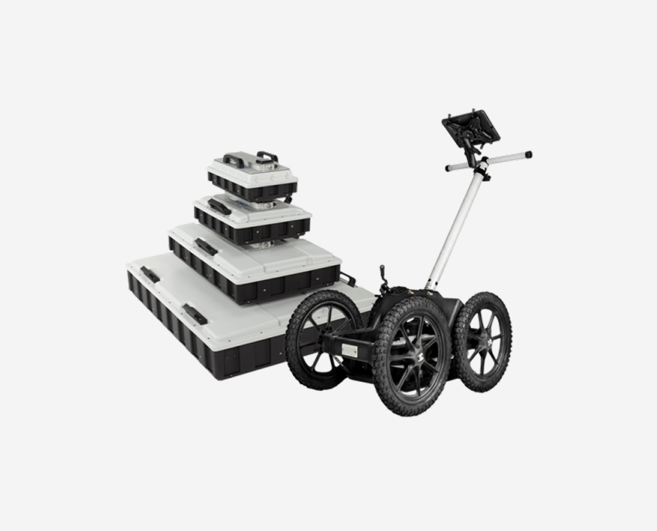
Large-scale 3D GPR mapping. Multiple carrier solutions for maximum operational flexibility.
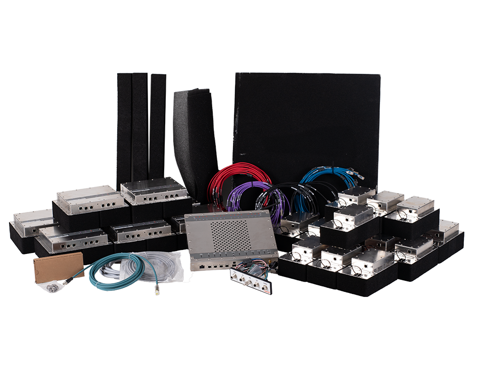
A modular, custom-built 3D ground-penetrating radar (GPR) array, only offered for integration into tailored solutions and specialized platforms.
MALÅ MIRA acquisition software
Newsletter
Sign up for Guideline Geo’s newsletter and be the first to know.