Exploration & Mining
Defense & Forensic
Infrastructure & Construction
Archaeology & Cultural heritage
Climate & Environmental
Learn more
ABEM
MALÅ
Software
Rental
Authorized Distributor
News
Calendar (events)
Opinion pieces
Press releases
More reading
Vision
History
Career
Privacy policy
Code of conduct
Whistleblower
Get in touch
Get in touch with us for expert help
Match your ABEM and MALÅ product with the recommended software.
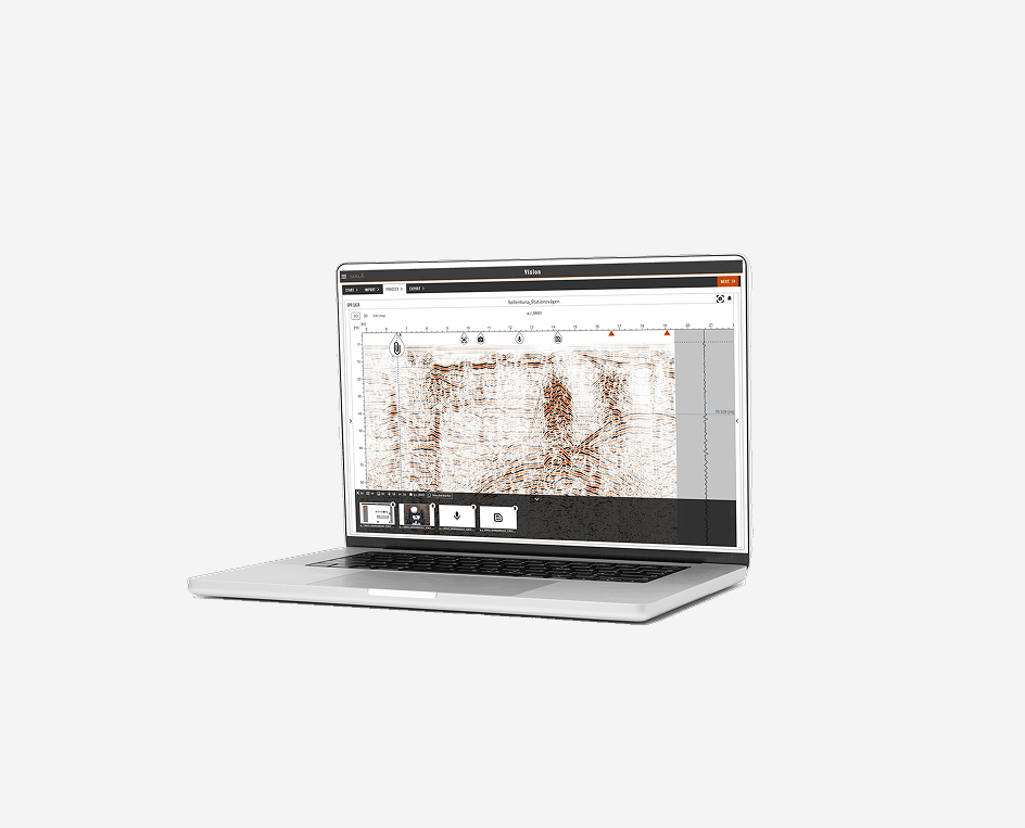
Intelligent GPR processing and analysis software on any device
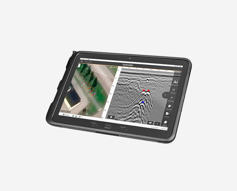
GPR data acquisition on your mobile device.
MALÅ MIRA acquisition software
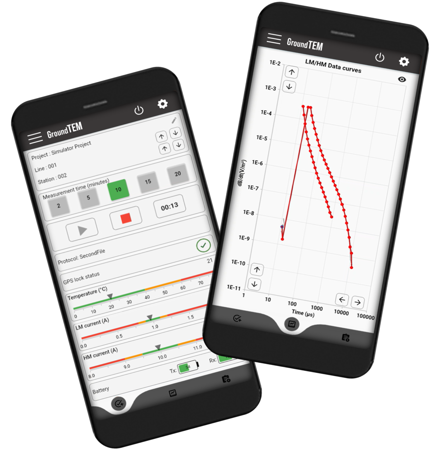
User-friendly software solutions for GroundTEM data acquisition on your mobile device.
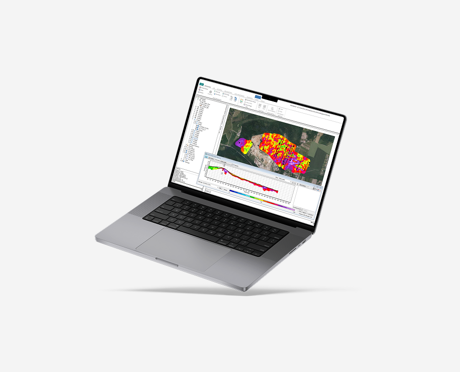
User-friendly software solutions for processing, inversion, and visualization of geophysical data from a wide range of electrical and electromagnetic methods.
Newsletter
Sign up for Guideline Geo’s newsletter and be the first to know.