Using Resistivity and TEM to Identify Aquifer Pathways and Pollution Plumes
Fresh groundwater is a finite resource under pressure from rapid urbanization and industrial growth. To manage these resources, we must visualize the invisible. Our geophysical methods – specifically Electrical Resistivity Tomography (ERT) and Transient Electromagnetics (TEM) – provide high-resolution imagery of the subsurface without the high cost and footprint of excessive drilling.
Identifying Contamination Pathways
Whether dealing with industrial runoff or agricultural leached nitrates, understanding the geological “plumbing” is essential. Our instruments identify natural barriers, like impermeable clay layers, and pinpoint high-permeability pathways that could carry pollutants directly into your aquifer.
Monitoring Saline Intrusion in Coastal & Over-Extracted Aquifers
Saline intrusion is a critical threat in coastal regions. Over-extraction can disrupt the delicate balance between fresh and sea water, drawing mineralized brine into previously fresh reservoirs. By mapping resistivity contrasts, we can precisely delineate the fresh-saline interface, allowing for better-informed extraction limits and aquifer recharge strategies.

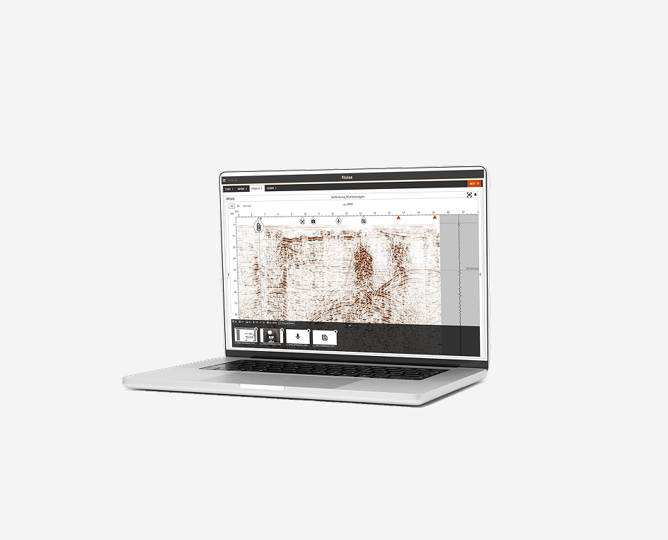
Groundwater Investigations: Detect Salinity and Pollution with TEM and Resistivity
Guideline Geo´s wide range of geophysical investigation techniques can solve most of the common questions regarding groundwater contamination and salination. They will provide a non-destructive and cost-efficient way of gaining a better understanding of the ground conditions, supplying better data coverage than is normally achieved with traditional, discrete, point-by-point geotechnical investigations and sampling, such as drilling or digging.
For groundwater applications in general it is necessary to use a physical property that can distinguish water from surrounding geologies, regardless of whether the water is found in unconsolidated materials (e.g. gravel, sand or silt), in rock fractures or in water-bearing permeable rock. Preferably it should also be possible to give information about the geological structures and layers. For contaminants and salination studies the method needs to be able to detect the difference between fresh and potentially hazardous water. As some aquifers can be found very deep, the geophysical method should preferably be able to ‘reach’ depths of 200 – 300 meters or maybe even deeper.
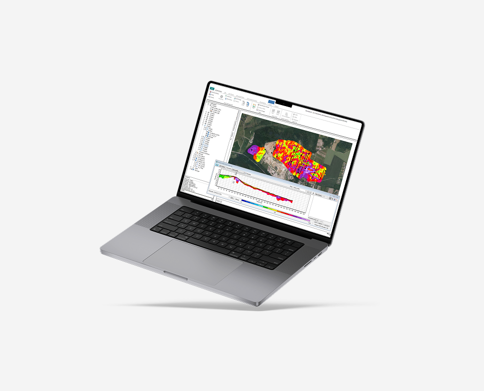
Guideline Geo provide efficient resistivity and TEM instrumentation, both very capable of mapping a physical property associated with the presence of contaminants and salination, a change of resistivity.
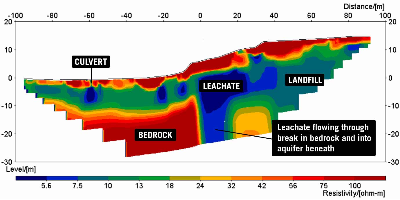
Typically, water has a low electrical resistivity, and thus most materials in which water is present will experience a change in resistivity from its original value. The more saturated with water a material is, the more its resistivity will change. Add to this the fact that salt has very low electrical resistivity, we can deduce that the higher the ion content of water, the lower the resistivity. This makes it possible to detect the difference between fresh water and saline water. If water is contaminated with a pollutant, in most cases its electrical properties will also change. Exactly how it will change depends on the pollutant but typically it will lower the resistivity due to an increased amount of dissolved ions.
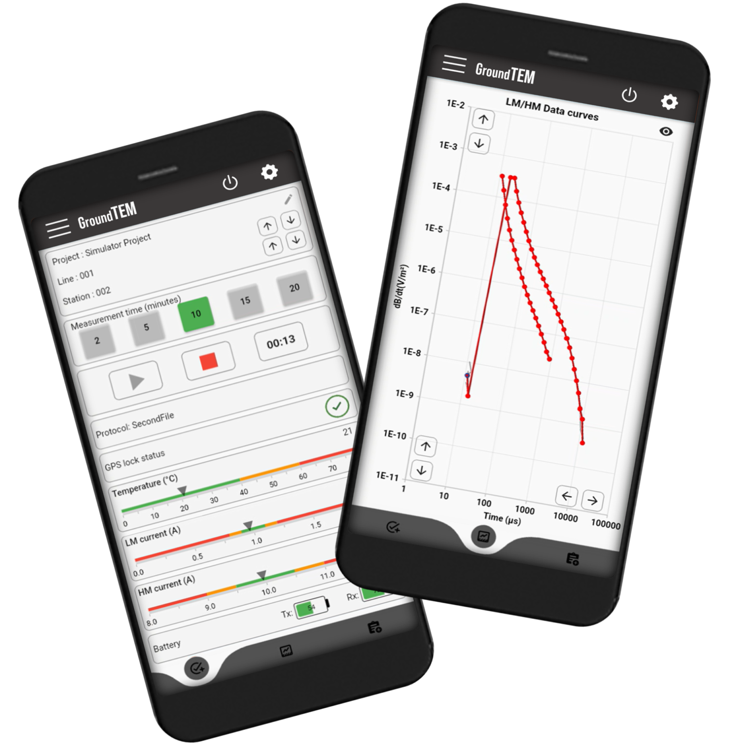
Resistivity and TEM investigations
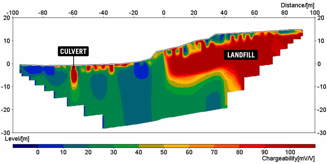
Resistivity and TEM measurements are most often used as part of a single investigation, identifying anomalous regions at a particular moment in time, but they are also very suitable for monitoring or time-lapse measurements. To be able to track the distribution and pace of leachate spreading around a landfill area, is an incredibly powerful tool.
Note! All ABEM resistivity equipment is capable of also recording the chargeability of the ground (how quickly it charges up and subsequently discharges with the application and removal of current) using time domain induced polarisation methods. This additional dataset can be very useful in mapping different types of waste in a landfill, or interpretation of targets such as mineral deposits and clays.
What method and technique to use?
Whilst there are many factors involved in deciding upon the correct solution for a given project, these are some of the key considerations:
- TEM is unsuitable in urban areas due to sources of electromagnetic disturbance.
- TEM is suitable for deep investigations (>500 m) where resistivity methods might be limited by access, equipment power or general survey practicalities.
- Resistivity requires galvanic contact via electrodes of some description which can be both hard and time consuming in environments with bare rock or asphalt etc.
- TEM or VES may be sufficient for broad prospection but ERT methods are best for more detailed results.
- TEM is not well suited to differentiating between highly resistive materials; the method responds better to conductive bodies.
- 1D methods (VES, TEM, VSP-Vertical Seismic Profile) are not well suited to identifying confined features like fracture zones and intrusions compared to 2D methods which offer lateral detail.
Combining methods
It is often beneficial to combine different geophysical methods to get the best resulting picture of the groundwater contamination or salination. For instance:
- 1D measurements with VES or TEM can be used to pin-point the most interesting area, where more thorough investigations with ERT can be made.
- It may be beneficial to supplement ERT with TEM soundings through those areas where investigation depth needs to be greater than that obtained with ERT.
- The combination of resistivity and IP can help refine an interpretation, for example resolving if waste is of organic or inorganic origin and thereby the type of groundwater contamination.
Other geophysical methods
Guideline Geo also provide GPR and seismic solutions, which can be beneficial for ground investigations relating to the mapping of contaminants or salination.
GPR
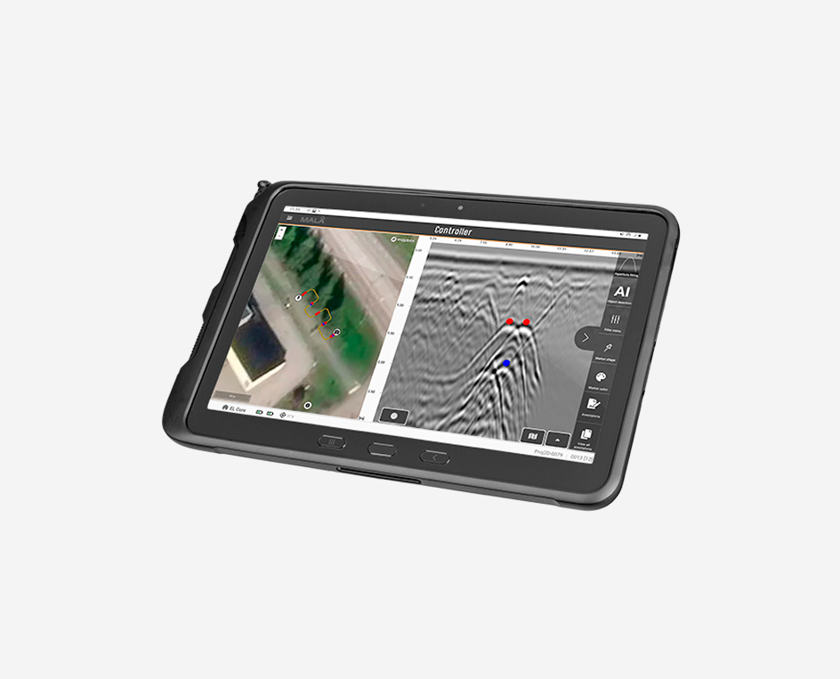
GPR can be used to map the bedrock topography (in other words pathways for groundwater and contaminants), the extent of protective clay layers, the thickness of friction soils etc. In some cases GPR can also be used to map the groundwater table, but this is limited to coarse grained soils.
Seismic methods
The seismic method is most commonly used for measure depth to bedrock, bedrock quality, soil stability or mapping of geological structures. But depending on the aquifer type it can in some situations be easy to detect the groundwater table. The porosity and water saturation decides if seismics will resolve a groundwater surface. Seismics will not be able to differentiate fresh water from salt water or polluted water.