Locate buried metallic and non-metallic utilities

The MALÅ Easy Locator series is the standard within utility locating using GPR. Providing the best data quality on the market, ease-of-use and unsurpassed precision.

MALÅ Easy Locator revolutionized the utility market with a completely new approach. With its rugged design, ease of use, best data quality and outstanding precision, it is the standard within the locating industry. The dual antenna WideRange option is suitable for both shallow high-resolution surveys and deeper investigations.


REQUEST QUOTE


Application Areas

The MALÅ Easy Locator series is focused on utility locating and mapping but can also be used for a range of different applications, such as:

Features

The next step in GPR system evolution

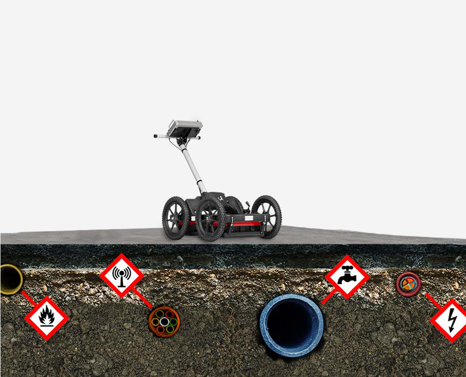
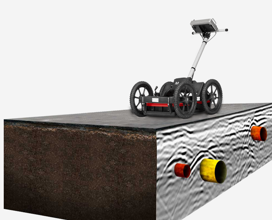
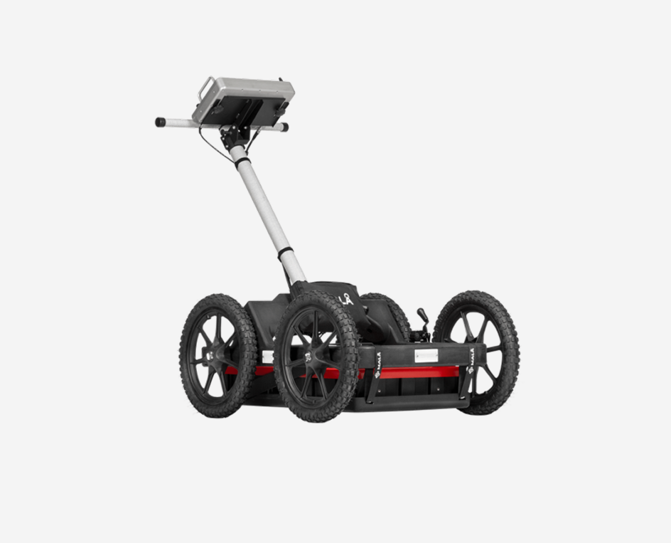
MALÅ HDR real-time technology delivers ultra-fast data acquisition.

MALÅ HDR technology is faster, offers the best data resolution, and has significantly better penetration depth than competitive products.
Due to the real-time sampling technology, antenna design and pulse generator, HDR offers much broader bandwidth, producing both higher resolution and better depth penetration at comparable centre frequencies. The HDR technology is ultra-fast and will stack each data point up to thousand times, drastically improving signal to noise ratio. The MALÅ Easy Locator series is the gold standard for GPR data quality.

Dual antenna GPR for utility locating


Designed for utility locating and mapping

Built on experience – Designed for its application


The Locating industry demands high quality, ruggedized and precise GPR equipment. Field equipment needs to be easy to transport, quick to setup and use, and with necessary functionality to efficiently getting the job done. The MALÅ Easy Locator is the market leader in GPR utility locating and mapping. Its functional design and ease of use is appreciated by utility locators world-wide.

Precise positioning

Precise positioning is key for effective buried assets management


Buried utilities are assets that needs proper geo-referencing. Both planar coordinates and depth are needed to protect these assets from costly mistakes and accidents. MALÅ Easy Locator WideRange has built-in DGPS (SBAS) and supports all major brands of stand-alone, high-precision, GPS solutions. Guideline Geo also provides Emlid RTK GPS for sub-centimetre accuracy if needed.

MALÅ Controller App

ANALYZE AND PROCESS DATA ON YOUR MOBILE DEVICE

Visualize and present GPR data in 2D and 3D


MALÅ Easy Locator WideRange data is easily imported directly into MALÅ Vision. MALÅ Vision is the easiest to use software in the industry. It is the fastest way to go from data collection to delivering a report.

Import, process, interpret and report your data directly in the field using a mobile device. MALÅ Vision provides a very efficient work-flow and is cutting work hours down to a minimum.

EXPLORE MALÅ VISION

MALÅ Vision data example with pipes showing


Rough Terrain Cart

For all GPR surveys conducted on rough surfaces

The MALÅ Easy Locator WideRange antenna and monitor can be mounted in the MALÅ Rough Terrain Cart (RTC), increasing the operational capabilities in more rugged terrain. The cart is available in two sizes, to accommodate the choice of antenna.

MALÅ Rough Terrain Cart for GPR antennas


Our MALÅ range of geophysical solutions can be used for multiple geological applications. The GPR method is commonly used where digging, coring, or drilling is not allowed, or needs to be reduced to minimize cost. GPR can quickly add useful information when other sparsely sampled information is not detailed enough.​

LEARN MORE ABOUT ground penetrating radar

Contact us for expert help

  • This field is for validation purposes and should be left unchanged.