- Products
- Applications
- Application Areas
- Archaeology
- Asphalt Investigations
- Bedrock Mapping
- Concrete and Rebar
- Dam Safety
- Groundwater Contaminants and Salination
- Groundwater Prospection
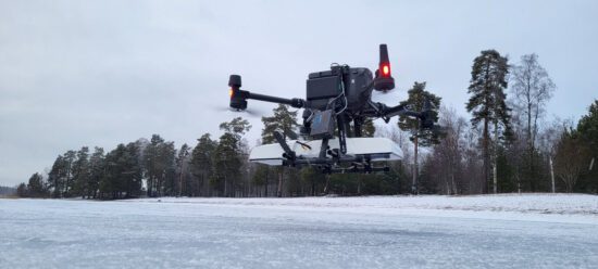
- Ice and Snow Investigations
- Mineral Exploration
- Mining operations
- Post mining operations
- Road Investigation and Mapping
- Tunnel Inspection
- Utility Locating
- Waste deposits
- Methods
- Case Stories
- A comparative study of Single Channel and Hand-Pushed Array Ground Penetrating Radar (GPR) Systems for Utility detection
- Manganese ore exploration using electrical resistivity and induced polarization methods
- Joining geotechnical investigations with geophysical results
- Subsurface evaluation of copper ore deposits
- Resistivity investigations for a water storage dam in Pakistan
- Mapping of hydrocarbon contaminants with Electrical Resistivity Tomography (ERT)
- Mapping fiber optic cables with GPR
- Resistivity investigations in the Scottish Highlands
- Resistivity Investigations to map Groundwater sources
- GPR and Resistivity working together
- GPR investigations at the Castle of Monteagudo
- GPR for utility mapping & detection
- Mapping the depth to bedrock
- Bedrock and Aquifer mapping
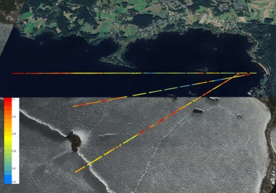
- Marine geophysical survey in subway extension project – Res/IP
- Utility locating with MALÅ MIRA in Italy x 4
- Fresh Water intrusion in saline aquifer
- Successful prospecting of groundwater in Bolivia
- Large scale utility mapping
- Mapping of heat pipes and electrical wires
- All Case Stories
- Opinion pieces
- A hard-working field geophysicist
- An investigation into spurious frequencies
- Endless resources. Not.
- Geotechnical Engineers and Geophysicists – the perfect match
- Geotechnical Engineers and Geophysicists – the perfect match Part II
- Ice and Snow, or maybe thaw
- Our crowded subsurface – Part I
- Our crowded subsurface – Part II
- Our finite groundwater resources
- Our planet, not a waste dump
- Our Production Wizards
- Help articles
- Application Areas
- Support
- Rental
- Contact
- Events
- News
- About
- Get quote